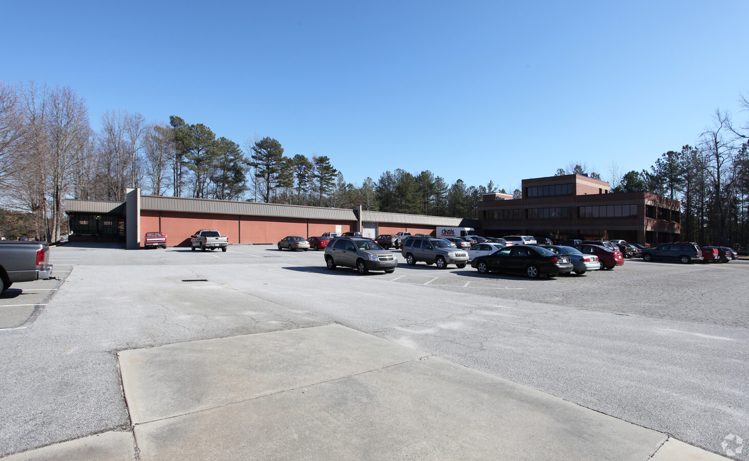
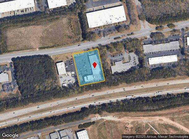
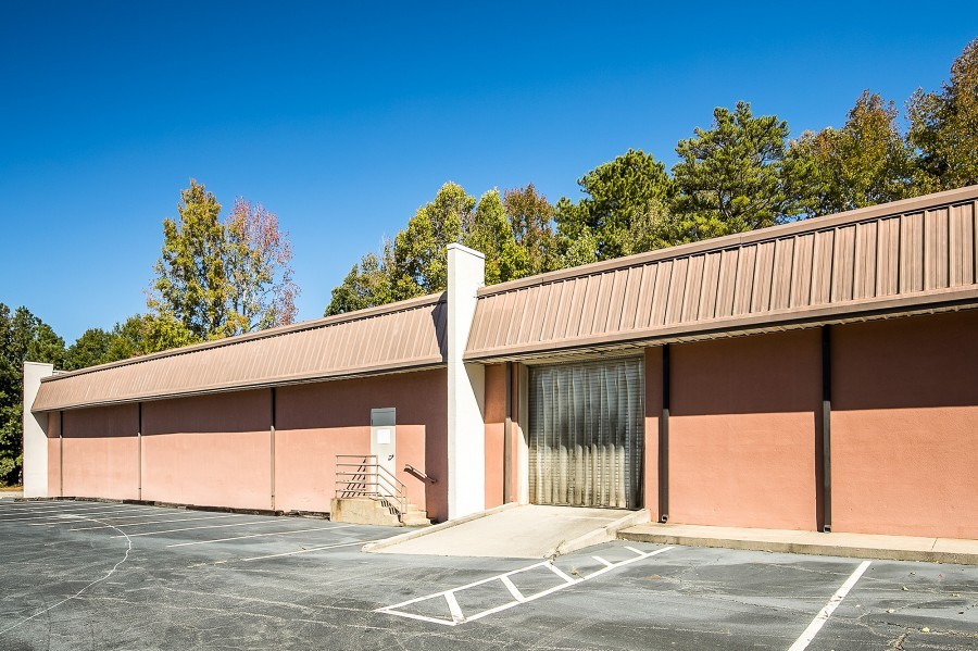
Property Record
922 Hurricane Shoals Rd Ne, Lawrenceville, GA 30043
NEARBY LISTINGS FOR SALE OR LEASE
Property Detail
922 Hurricane Shoals Rd Ne
Atlanta-Sandy Springs-Roswell, GA
Donald W Dawson
5-209-008
HWY 316
Warehouse
Gwinnett
X
Georgia
13135C0074F
a
2024
2.09 AC
2023
GA-316/Lawrenceville
050583
Atlanta
37,500 SF
DEMOGRAPHICS near 922 Hurricane Shoals Rd Ne
1 Mile
3 Mile
5 Mile
2024 Total Population
2,749
62,298
178,358
2029 Population
2,887
65,085
186,318
Pop Growth 2024-2029
+ 5.02%
+ 4.47%
+ 4.46%
Average Age
37
36
37
2024 Total Households
687
19,461
56,794
HH Growth 2024-2029
+ 5.97%
+ 4.66%
+ 4.58%
Median Household Inc
$82,518
$73,869
$80,844
Avg Household Size
3.10
3.00
3.00
2024 Avg HH Vehicles
2.00
2.00
2.00
Median Home Value
$264,696
$291,344
$290,504
Median Year Built
1995
1998
1997
Nearby Places
- Restaurants
- Banks
- Shops
- Fitness
- Groceries
SALE & LEASE HISTORY
LISTING DATE
SALE/LEASE

Sep 24, 2016
For Sale
Sep 19, 2024
For Sale
Nearby Properties
Address
Land Use
TOTAL SIZE
Lot Size
Zoning
Address
Land Use
TOTAL SIZE
Lot Size
Zoning
29,294 SF
24.24 AC
LM
Address
Land Use
TOTAL SIZE
Lot Size
Zoning
1,103,220 SF
66.65 AC
OI
Address
Land Use
TOTAL SIZE
Lot Size
Zoning
1,071,116 SF
74.52 AC
OI
Address
Land Use
TOTAL SIZE
Lot Size
Zoning
774,131 SF
159.36 AC
RS180
Address
Land Use
TOTAL SIZE
Lot Size
Zoning
493,072 SF
12.67 AC
BG
Address
Land Use
TOTAL SIZE
Lot Size
Zoning
2,102,193 SF
291.25 AC
M1
Address
Land Use
TOTAL SIZE
Lot Size
Zoning
275,917 SF
13.34 AC
BG
Address
Land Use
TOTAL SIZE
Lot Size
Zoning
16,062 SF
89.78 AC
BG
Address
Land Use
TOTAL SIZE
Lot Size
Zoning
188,749 SF
103.66 AC
RA200
Address
Land Use
TOTAL SIZE
Lot Size
Zoning
321,476 SF
38.63 AC
RMM
Address
Land Use
TOTAL SIZE
Lot Size
Zoning
298,990 SF
24.16 AC
OI
Address
Land Use
TOTAL SIZE
Lot Size
Zoning
242,492 SF
19.14 AC
RM13
Address
Land Use
TOTAL SIZE
Lot Size
Zoning
223,012 SF
46.14 AC
R75
Address
Land Use
TOTAL SIZE
Lot Size
Zoning
93,022 SF
68.90 AC
R100
Address
Land Use
TOTAL SIZE
Lot Size
Zoning
179,498 SF
6.05 AC
HSB
Address
Land Use
TOTAL SIZE
Lot Size
Zoning
393,811 SF
66.81 AC
M1
Address
Land Use
TOTAL SIZE
Lot Size
Zoning
126,160 SF
15.15 AC
BG
Address
Land Use
TOTAL SIZE
Lot Size
Zoning
175,190 SF
11.17 AC
RM
Address
Land Use
TOTAL SIZE
Lot Size
Zoning
284,415 SF
17.55 AC
OI-OFFICE-
Address
Land Use
TOTAL SIZE
Lot Size
Zoning
327,884 SF
19 AC
M1-LIGHT I
Address
Land Use
TOTAL SIZE
Lot Size
Zoning
140,240 SF
25.54 AC
R100
Address
Land Use
TOTAL SIZE
Lot Size
Zoning
212,571 SF
31.30 AC
RA200
Address
Land Use
TOTAL SIZE
Lot Size
Zoning
240,509 SF
19.18 AC
RM
Address
Land Use
TOTAL SIZE
Lot Size
Zoning
176,034 SF
92.85 AC
RA200
Address
Land Use
TOTAL SIZE
Lot Size
Zoning
149,440 SF
28.41 AC
M1
Address
Land Use
TOTAL SIZE
Lot Size
Zoning
229,868 SF
17.46 AC
RM
Address
Land Use
TOTAL SIZE
Lot Size
Zoning
213,116 SF
15.09 AC
RM12
Address
Land Use
TOTAL SIZE
Lot Size
Zoning
275,000 SF
19.84 AC
M1-LIGHT I
Address
Land Use
TOTAL SIZE
Lot Size
Zoning
295,712 SF
18 AC
RM24
Address
Land Use
TOTAL SIZE
Lot Size
Zoning
249,600 SF
17.35 AC
M1
The World's #1 Commercial Real Estate Marketplace
Connect with us
© 2025 CoStar Group
The information above has been obtained from sources believed reliable. While we do not doubt its accuracy we have not verified it and make no guarantee, warranty or representation about it. It is your responsibility to independently confirm its accuracy and completeness. Any projections, opinions, assumptions, or estimates used are for example only and do not represent the current or future performance of the property. The value of this transaction to you depends on tax and other factors which should be evaluated by your tax, financial, and legal advisors. You and your advisors should conduct a careful, independent investigation of the property to determine to your satisfaction the suitability of the property for your needs.